ਭਾਰਤੀ ਮੌਸਮ ਵਿਭਾਗ ਨੇ ਕਿਹਾ ਕਿ ਹਵਾ ਦੀ ਦਿਸ਼ਾ ਅਤੇ ਮੌਸਮ ਦੀ ਸਥਿਤੀ ਕਾਰਨ ਮੌਨਸੂਨ ਅਗਲੇ ਹਫਤੇ – ਪੜ੍ਹੋ ਮੌਸਮ ਦੀ ਭਵਿੱਖਬਾਣੀ
ਨਿਊਜ਼ ਪੰਜਾਬ
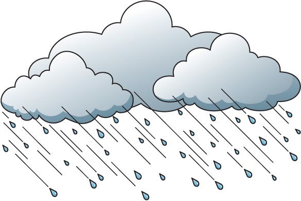
ਭਾਰਤੀ ਮੌਸਮ ਵਿਭਾਗ (ਆਈ.ਐਮ.ਡੀ.) ਨੇ ਸ਼ਨੀਵਾਰ ਨੂੰ ਕਿਹਾ ਕਿ ਹਵਾ ਦੀ ਦਿਸ਼ਾ ਅਤੇ ਹੋਰ ਮੌਸਮ ਦੀ ਸਥਿਤੀ ਕਾਰਨ ਪੂਰੇ ਪੰਜਾਬ ਅਤੇ ਇਸ ਦੇ ਨਾਲ ਲੱਗਦੇ ਇਲਾਕਿਆਂ ਵਿੱਚ ਮੌਨਸੂਨ ਦੀ ਬਾਰਸ਼ ਇਸ ਸਮੇਂ ਅਨੁਕੂਲ ਨਹੀਂ ਹੈ। ਕੁਝ ਇਲਾਕਿਆਂ ਵਿੱਚ ਹੋ ਰਹੀ ਬਾਰਸ਼ ਤੋਂ ਇਲਾਵਾ ਬਾਕੀ ਇਲਾਕਿਆਂ ਵਿੱਚ ਅਜਿਹੀ ਸਥਿਤੀ ਵਿੱਚ, ਇੱਥੇ ਮੌਨਸੂਨ ਦੀ ਪਹਿਲੀ ਬਾਰਸ਼ ਦਾ ਨਜ਼ਾਰਾ ਵੇਖਣ ਵਿੱਚ ਇੱਕ ਹੋਰ ਹਫਤਾ ਲੱਗ ਸਕਦਾ ਹੈ। ਆਈਐਮਡੀ ਨੇ ਪੱਛਮੀ ਉੱਤਰ ਪ੍ਰਦੇਸ਼, ਪੰਜਾਬ, ਹਰਿਆਣਾ, ਚੰਡੀਗੜ੍ਹ ਅਤੇ ਰਾਜਸਥਾਨ ਦੇ ਬਾਕੀ ਹਿੱਸਿਆਂ ਵਿੱਚ ਸੱਤ ਦਿਨਾਂ ਬਾਅਦ ਹੀ ਮੌਨਸੂਨ ਬਾਰਸ਼ ਦੀ ਸ਼ੁਰੂਆਤ ਦੀ ਭਵਿੱਖਬਾਣੀ ਕੀਤੀ ਹੈ।
ਆਈਐਮਡੀ ਅਨੁਸਾਰ ਉੱਤਰ ਪੱਛਮੀ ਭਾਰਤ (ਦਿੱਲੀ, ਪੰਜਾਬ, ਹਰਿਆਣਾ, ਰਾਜਸਥਾਨ ਆਦਿ) ਵਿੱਚ ਮੌਜੂਦ ਪਏ ਤੇਜ਼ ਹਵਾਵਾਂ ਮਾਨਸੂਨ ਦੇ ਰਸਤੇ ਨੂੰ ਰੋਕ ਰਹੀਆਂ ਹਨ। ਇਹ ਸਥਿਤੀ ਅਗਲੇ ਇੱਕ ਹਫ਼ਤੇ ਤੱਕ ਜਾਰੀ ਰਹਿਣ ਦੀ ਉਮੀਦ ਹੈ. ਹਾਲਾਂਕਿ, ਅਗਲੇ ਪੰਜ ਦਿਨਾਂ ਦੌਰਾਨ ਇਨ੍ਹਾਂ ਇਲਾਕਿਆਂ ਵਿੱਚ ਮਾਨਸੂਨ ਤੋਂ ਪਹਿਲਾਂ ਪਏ ਮੀਂਹ ਦੀ ਸੰਭਾਵਨਾ ਹੈ।
The northern Limit of southwest monsoon (NLM) continues to pass through, Barmer,Bhilwara,Dholpur, Aligarh,Meerut, Ambala and Amritsar
According to the National Weather Forecasting Centre of the India Meteorological Department:
(Saturday26June2021, Time of Issue:1615hoursIST)
Based on 1430 hours IST Observations
AllIndiaWeatherInference(EVENING)
- The northern Limit of southwest monsoon (NLM) continues to pass through Lat. 26°N / Long. 70°E, Barmer, Bhilwara, Dholpur, Aligarh, Meerut, Ambala and Amritsar.
- Prevailing meteorological conditions, large scale atmospheric features and the forecast wind pattern by dynamical models suggest that no favourable conditions are likely to develop for further advance of southwest monsoon into remaining parts of Rajasthan, west Uttar Pradesh, Haryana, Chandigarh &Delhi and Punjab during next 7days.
- The trough at mean sea level from East Uttar Pradesh to north west Bay of West Bengal persists.
Bengal across Jharkhand and Gangetic
- The cyclonic circulation over Jharkhand & neighbourhood extending up to 3.1 km above mean sea level persists.
- The other cyclonic circulation over south Odisha & neighbourhood between 0.9 km & 2.1 km above mean sea level persists.
- The cyclonic circulation over Northwest Rajasthan & neighbourhood extending up to 2.1 km above mean sea level persists.
- The cyclonic circulation over Northeast Rajasthan & neighbourhood at 0.9 km above mean sea level persists.
- ThecycloniccirculationoversouthwestRajasthan&neighbourhoodat5.8kmabovemeansealevelpersists.
- The cyclonic circulation over south Gujarat region & neighbourhood between 2.1 km & 3.1 km above mean sea levelpersists.
- Thecycloniccirculationoverwest centralArabianSeaoffsouthOmancoastbetween3.1km&5.8kmabovemeansealevel persists.
- TheWesternDisturbanceasatroughinmid&uppertroposphericwesterlieswithitsaxisat5.8kmabovemeansealevelroughly along Long.71°Eto the north of Lat. 28°Npersists.